
Designed to meet the time constraints for electric utilities, Network Surveyor combines unmatched lidar technology with edge processing to deliver actionable data in near real time.

Powered by Galaxy Edge
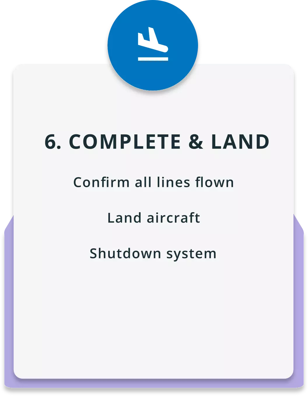
Designed specifically to meet the time constraints for electric utilities, Network Surveyor combines unmatched lidar technology with edge processing to deliver actionable data in near real time. Land with data ready for ingestion into the digital twin and identify critical infrastructure risks within hours. Network Surveyor lowers operating costs, reduces risk and increases public safety of critical infrastructure assets.
Find out more about Network Surveyor and it's powerful, real-time data benefits for utility companies.
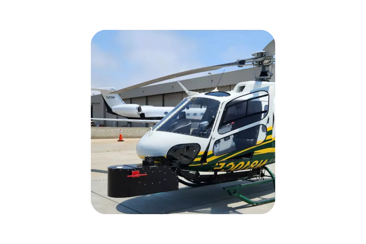
With Network Surveyor there are multiple options for collecting 3D lidar data depending upon the size of your service area. These options range from UAV Lidar sensors for small territories or organizations with mature UAV operations, small Helicopter solutions to mid-sized territories, and large Helicopter or Fixed-Wing solutions for large territories. The solutions can be customized with multiple high resolution cameras to simultaneously capture inspection imagery.
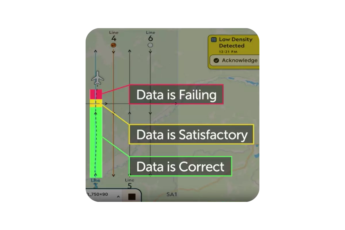
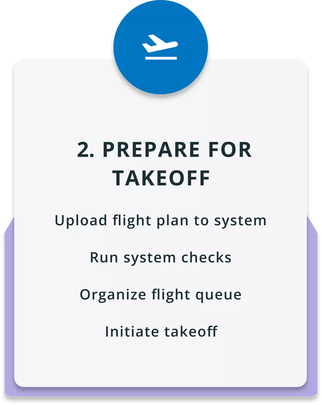
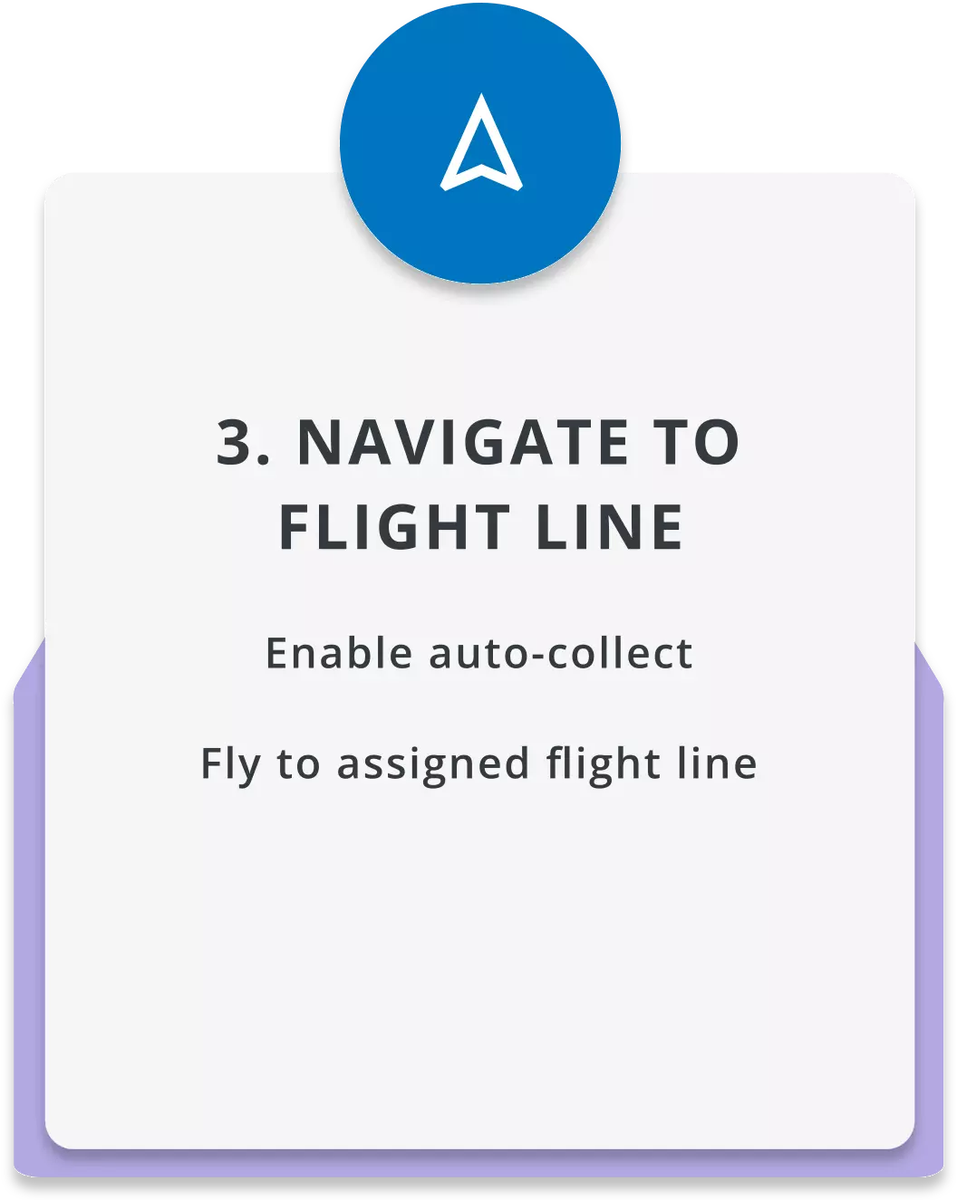
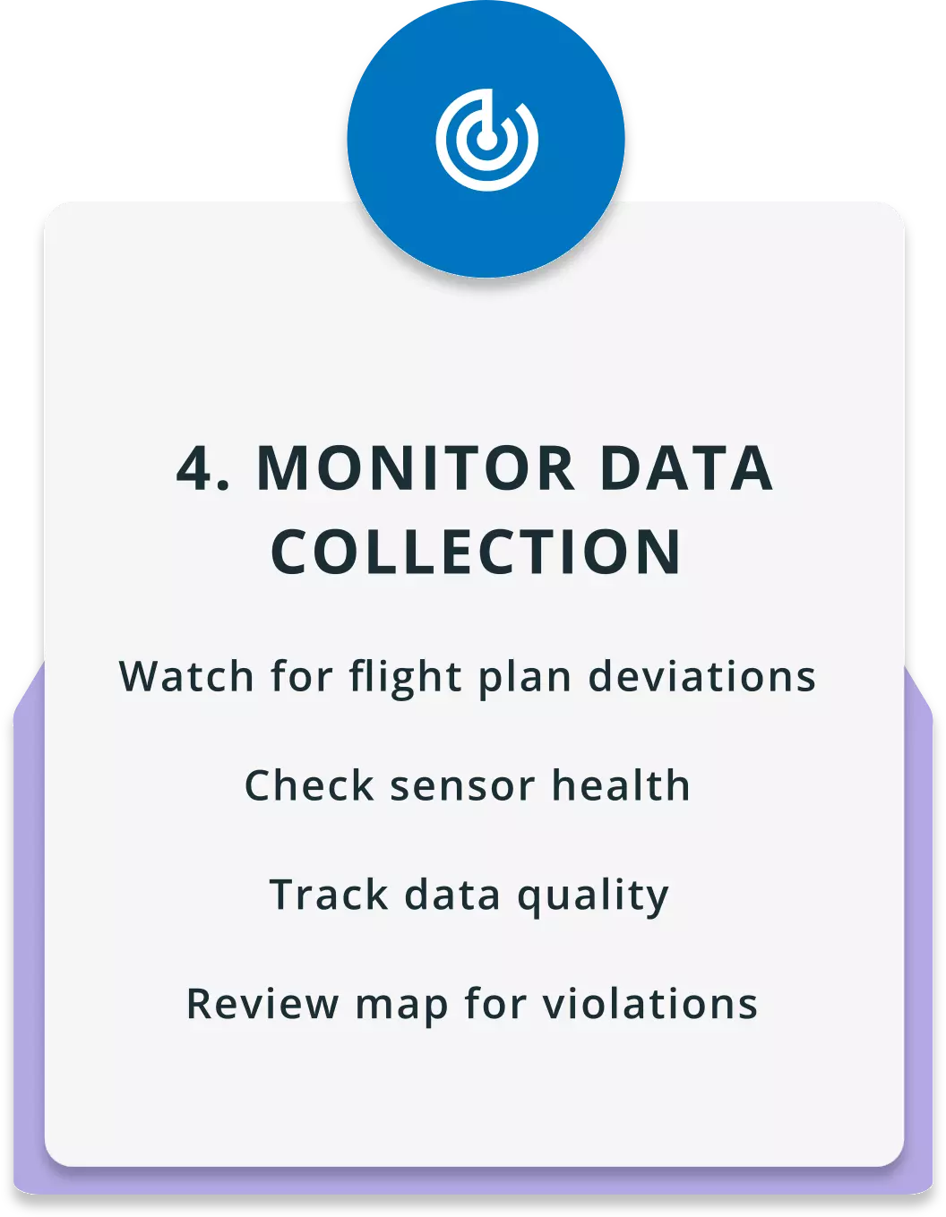
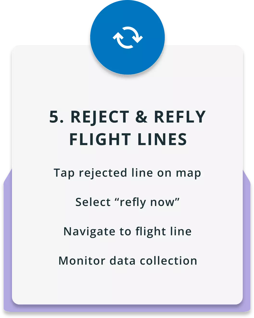
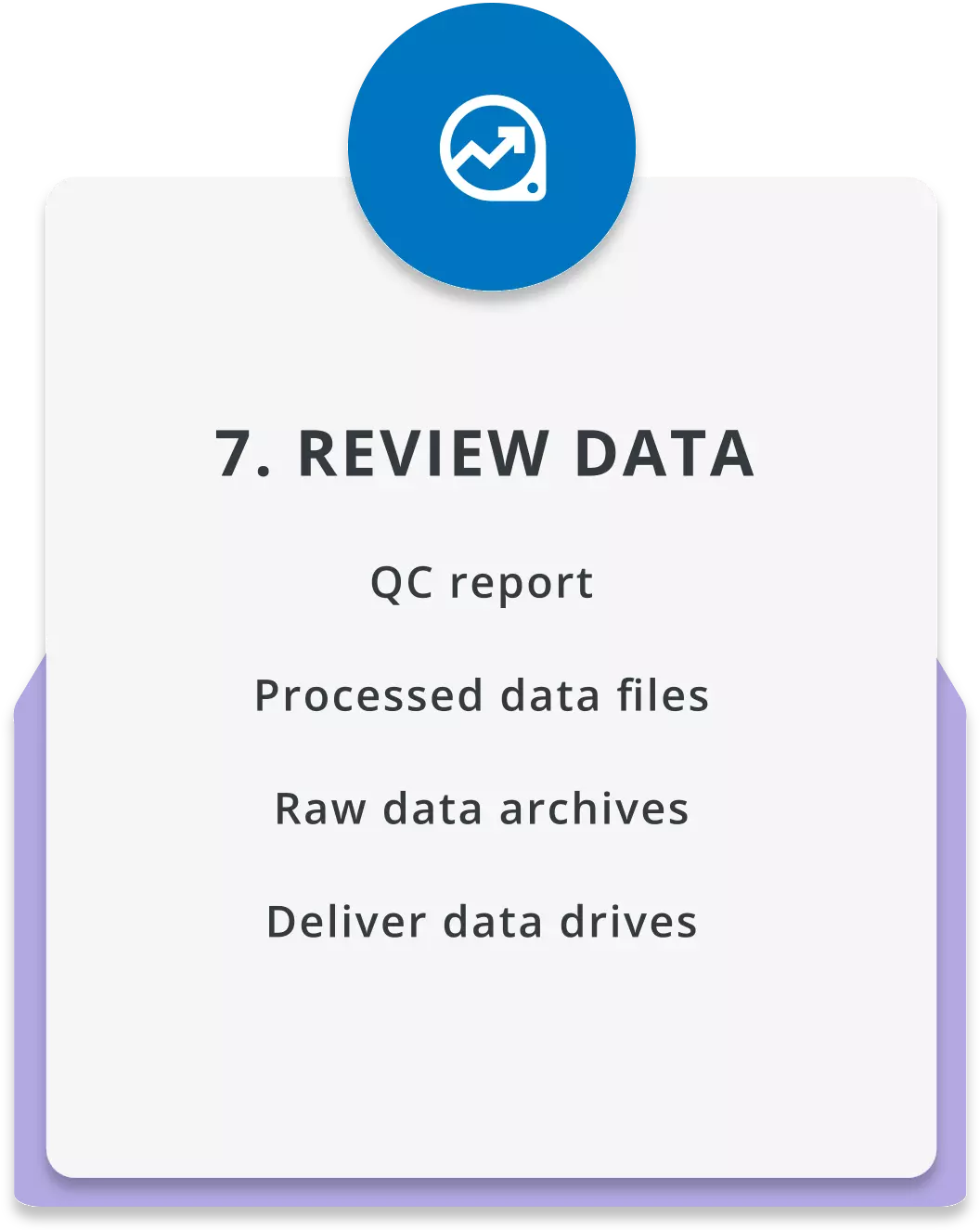
Network Surveyor’s lidar and camera sensors deliver efficient data acquisition with full density accurate georeferenced point clouds and camera imagery generated in real-time onboard the aircraft. With Onboard operator interface data is quality controlled in real-time to ensure acquisition meets requirements allowing in-flight reflight if necessary.
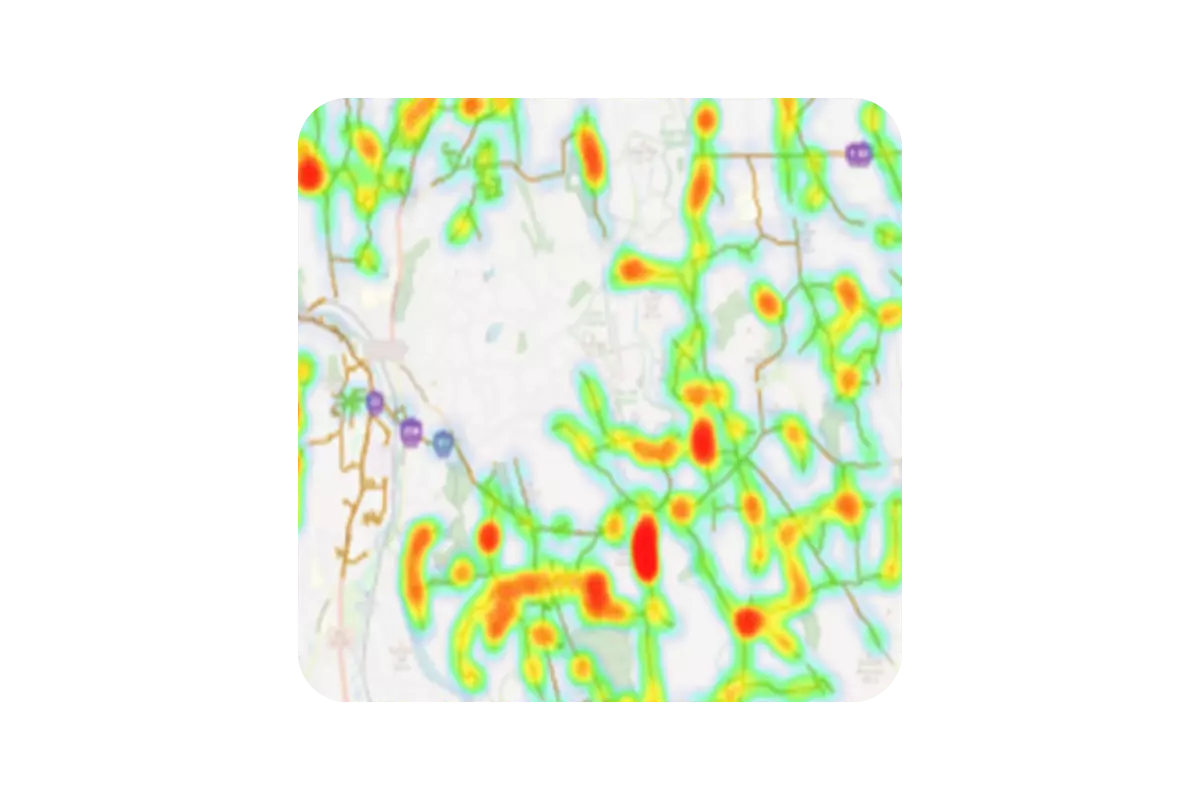
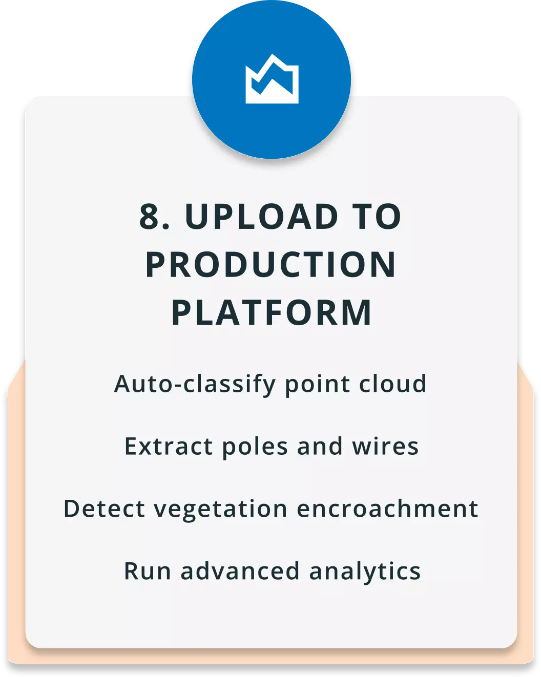
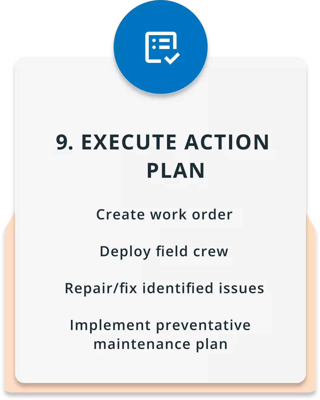
Immediately after acquisition inflight generated lidar point clouds are available for ingest to analytics platforms for automatic creation of the network digital twin to generate risk metrics across multiple use cases in a fraction of the time of traditional workflows. The digital twin coupled with auto classification of the lidar data and utility GIS data is the basis to produce customizable vegetation encroachment reports, identification of strike trees, asset inspection, GIS pole conflation vectors, conductor clearance analysis, pole loading inputs and more. Generate insight that is consumable by end users at infinite scale.
To address the utility market, Teledyne Geospatial designed three core workflow elements to deliver actionable data in real time. Discover what's inside here.

The Galaxy Edge is an industry-leading airborne lidar boasting a 2MHz pulse rate making high resolution mapping of utility assets fast and cost effective. The compact size of the Galaxy offers unmatched versatility and is compatible with both airplane and helicopter platforms making any project achievable regardless of specification.
The latest release of Galaxy is the 7th generation sensor. Providing tailored enhancements for small object detection, it is the core of Network Surveyor. Building on the foundational technology of T2000, performance improvements include:

Galaxy Onboard is a groundbreaking industry first; REAL TIME processing and quality control edge processing solution that operates from the aircraft during data collection. Data is processed and analyzed in real time ensuring all required data is captured successfully. Combined with real-time trajectory corrections applied in the air, the point cloud accuracy achieved in the air produces sub 15cm absolute accuracy of that data on landing.
High accuracy point clouds produced in real-time can immediately be imported into leading digital-twin platforms for analytics upon landing of the aircraft. True rapid-reporting and response with Teledyne Utility solutions.
Download the brochure
Phase One imagery solutions provide concurrently captured oblique and nadir imagery data to verify the point cloud analysis. The best in industry imagery solutions from Phase One support asset inspection image analysis and orthomosaic products for a complete digital record of infrastructure.
Network Surveyor focuses on data outcomes and speed of analytics. Through a fully integrated sensor solution, user-friendly UI and real-time processing, the barrier of entry into geospatial data acquisition has never been easier.
The fully integrated solution comes with an STC approved heli-pod mount for Bell 206 and AS350 helicopter platforms. A complete sensor integration kit allows for easy installation and efficient flight operations.
| Brochures | |
|---|---|
| Network Surveyor Brochure | View and Download the Network Surveyor brochure. |
| Onboard Brochure | View and Download the Onboard brochure. |
Search for your nearest Teledyne OPTECH office location.
Contact our dedicated ream of technical support specialists anywhere, any time.
Contact sales and request further information about Teledyne OPTECH products and solutions.

