
Teledyne Optech unveils Stratus, a compact, high-resolution lidar system for lightweight aircraft, offering unmatched precision and plug-and-play deployment - live at INTERGEO 2025.
Wednesday - 01 October 2025
Toronto, ON — October 2, 2025 — Teledyne Optech will bring its latest sensor to INTERGEO to provide visitors an exclusive first look. Stratus, a compact, high-resolution lidar system designed for fast mobilization in lightweight aircraft and helicopters, weighs just 8 kg and is compatible with the AISPECO Heliux Lite pod. Stratus delivers true plug-and-play integration with no aircraft modifications required for deployment.
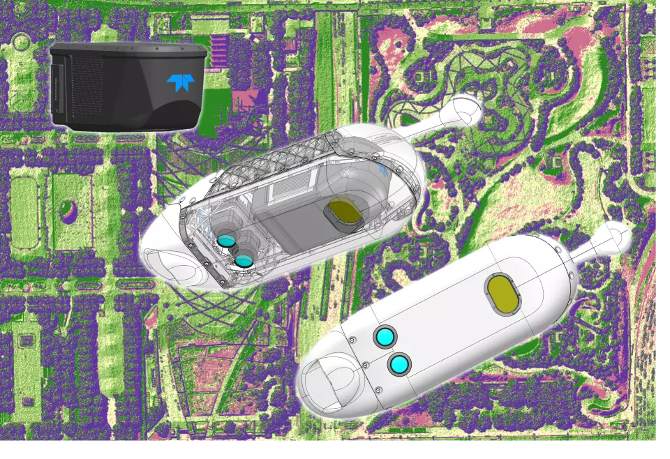
Stratus & PhaseOne dual camera integration in AISPECO Heliux Lite pod.
Built on Optech’s legacy of precision sensing, Stratus delivers the highest single pass point density on the market, is powered by a unique laser zoom capability, and has an effective pulse rate of 2 million points per second. Stratus enables users to scale effortlessly from targeted corridor mapping over powerlines or pipelines, to expansive wide-area surveys, and delivers projects rapidly.
Stratus is ideal for vegetation management, pole detection, and right-of-way mapping; it will be showcased live at INTERGEO 2025 - Hall 12.0, stand 0C067, and visitors are invited to come and see it firsthand.
“Stratus represents a strategic pivot for Teledyne Optech towards the mid-size and compact airborne lidar segments. With the Optech Stratus, operators of small aircraft, helicopters, and large UAV’s can now access Optech technology at an affordable price without compromise on performance and productivity. The Optech team have been working diligently to develop Stratus, and judging by the first customers to get their hands on it, we are very pleased with the result.” said Jean-Jacques Dupont, Vice President Optech. “It’s designed to help our customers move faster, cover more ground, and deliver results with unmatched precision.”